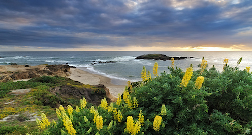
San Mateo County

FOUNDED: April
19, 1856
SIZE: 455 square miles of land; 292 square miles of water
INCORPORATED CITIES: 20
COASTLINE: 57.7 miles
ELEVATION: Sea level to 2,629 feet (near Long Ridge Road, La Honda)
POPULATION: 739,311
NUMBER OF HOUSING UNITS: 271,333
UNEMPLOYMENT RATE: 5.1 percent (October 2013)
AGRICULTURAL PRODUCTION: $140 million in 2012
*Information taken from the San Mateo County website.
About San Mateo:
San Mateo County is included in the San Francisco-Oakland-Hayward, CA Metropolitan Statistical Area, and is part of the San Francisco Bay Area, the nine counties bordering San Francisco Bay. It covers most of the San Francisco Peninsula. San Francisco International Airport is located at the northern end of the county, and Silicon Valley begins at the southern end. The county’s built-up areas are mostly suburban with some areas being very urban, and are home to several corporate campuses. * Information from Wikipedia
School Boundaries Per District
San Francisco (by property address)
|
List of Cities |
|
Transportation Options |
Entertainment |
|
|
|
|
|
|
BART |
Hillbarn Theatre |
||
|
Burlingame Shuttle |
Hiller Aviation Museum online walking tour |
||
|
Commute.org Transit Agencies Serving San |
San Mateo County History Museum |
||
|
Mateo County, CA |
San Mateo County Fair |
||
|
Foster City Sunshine Shuttle |
Shakespeare Festival |
||
|
Peninsula Corridor Joint Powers Board |
Shoreline Amphitheater |
||
|
San Francisco International Airport |
The Fillmore |
||
|
San Mateo Caltrain Connector |
Peninsula Symphony |
||
|
|
|
||
|
|
|
REALTOR®
Burlingame, CA 94010
